Deer
Scout deer ground on the map you already use
The same habitat ranking, tuned for whitetails, plus the state's reported deer harvest on public land and the counties where chronic wasting disease has been found.
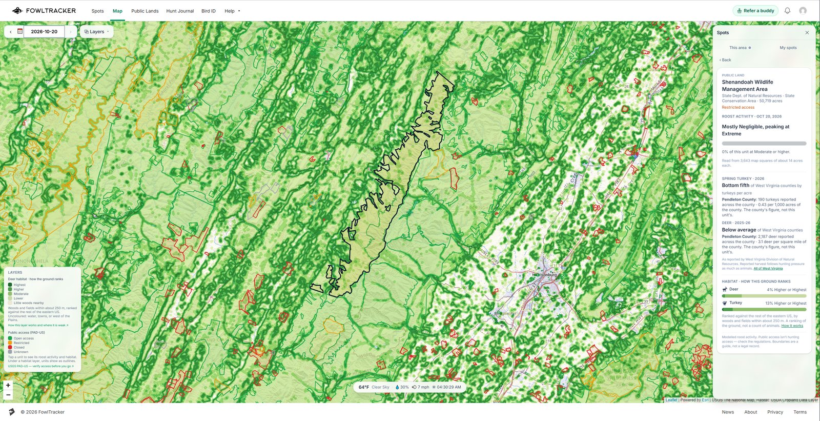
Deer habitat layer
Woods next to open ground, ranked
- Built for whitetails.
- Every 100-foot square scored on the mix of woods and fields in the few hundred yards around it. Deer are scored for a slightly more open mix than turkeys.
- Ranked against the eastern US.
- Highest, Higher, Moderate and Lower, compared with the rest of the eastern US, so ground in one state reads the same as ground in the next.
- On your spots.
- Each saved spot and hunt journal entry shows how its ground ranks for deer, and the Scout tab shows it for wherever the map is centered.
Deer on public land
Harvest figures the state actually publishes
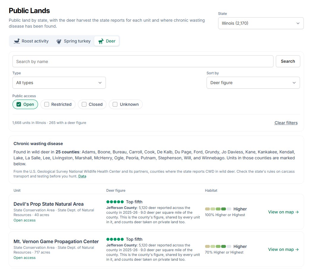
Each unit shows the state's own deer harvest figure: for the unit itself where the state reports by public area, or for its county where the state only counts by county.
- Harvest by area.
- Deer per square mile (South Carolina, Indiana), deer per 100 hunter-days (Florida), or deer reported (North Carolina, Tennessee, Oklahoma, Georgia), depending on what each state publishes.
- Harvest by county.
- Where the state only counts by county, units show the county's deer per square mile and are ranked against the state's other counties.
- Chronic wasting disease.
- Units are marked when they sit in a county where CWD has been found in wild deer, from the USGS National Wildlife Health Center. No mark does not mean CWD-free.
- Sort by habitat.
- Sort every unit in a state by how its ground scores for deer. Reported deer follow hunting pressure as much as deer numbers, so read the two together.
Deer harvest figures today
- Arkansas
- Florida
- Georgia
- Illinois
- Indiana
- Kentucky
- Maryland
- Missouri
- North Carolina
- Ohio
- Oklahoma
- South Carolina
- Tennessee
- Virginia
- West Virginia
Free and Premium
Try it on your own ground first
Free
The deer layer across the whole eastern US zoomed out, full detail around your first three saved spots, and one sample public land unit per state in full.
Premium
The habitat layer everywhere at every zoom, deer figures for every public land unit, and the habitat sort on the Public Lands list.
Start free and evaluate your own hunting ground.
Start free, save your spots, and see how it lines up with what you are seeing in the field.