Public Lands
Scout every piece of public ground in a state
Most hunting maps show you who owns the land. FowlTracker shows you what has been happening on it: roost activity for ducks and geese, the state's spring turkey and deer harvest, and how the ground ranks for each.
Waterfowl on public land
Find public ground birds have actually been using
Every wildlife refuge, WMA, national forest, and Corps of Engineers unit in a state, with the most recent roost reading for each one.
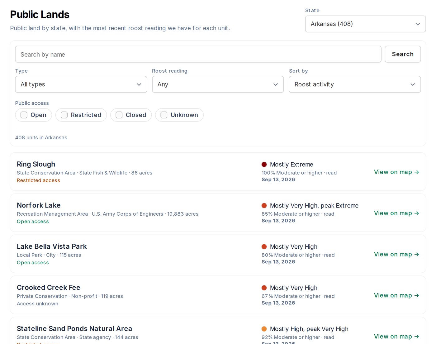
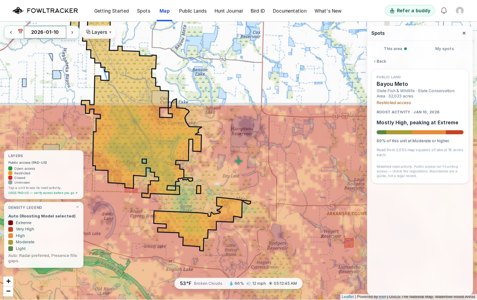
The Public Lands list is free for everyone; roost readings on it are part of Premium. Public access is not the same as hunting access, so always check the regulations before you go.
One list, three seasons
Switch tabs for what you are hunting
Roost
Every unit ranked by recent duck and goose roost activity from the Roost model. Premium shows the readings on every unit.
Spring turkey
State-reported spring harvest by area or by county in 16 states, with season dates, bag limit and brood surveys.
Deer
State-reported harvest by public area or by county in 15 states, plus chronic wasting disease counties.
Habitat column
Sort a whole state by how the ground scores
- Per unit, per species.
- Each unit on the Spring turkey and Deer lists gets a habitat rank from the same layer you see on the map, worked out over its whole boundary.
- Within a state.
- Read it next to the state's figure, not instead of it: a unit can rank well on habitat and still be hard hunted.
- Open it on the map.
- View on map opens the map centered on the unit, with its card open and both habitat bars on it.
Fine print
Where the numbers come from
- Boundaries.
- Public land boundaries from the USGS Protected Areas Database (PAD-US).
- Harvest, seasons and surveys.
- The state wildlife agency's own figures. Each list names the agency and links to its report, and says when the agency calls its numbers preliminary.
- Disease.
- Chronic wasting disease counties from the USGS National Wildlife Health Center.
- Access.
- Public does not always mean open to hunting. Check the state's rules for the unit before you go.
Free and Premium
Browse free, open everything with Premium
Free
The Public Lands list with roost filters in every state, and one sample unit per state in full on the Spring turkey and Deer tabs.
Premium
Roost readings, spring turkey and deer figures, and habitat ranks for every unit in every state.
Start free and evaluate your own hunting ground.
Start free, save your spots, and see how it lines up with what you are seeing in the field.