Turkey
Find the ground spring gobblers like
FowlTracker ranks the ground for wild turkeys across the eastern US, and puts the state's own spring harvest figures next to the public land it reports on. Same map, same subscription as duck season.
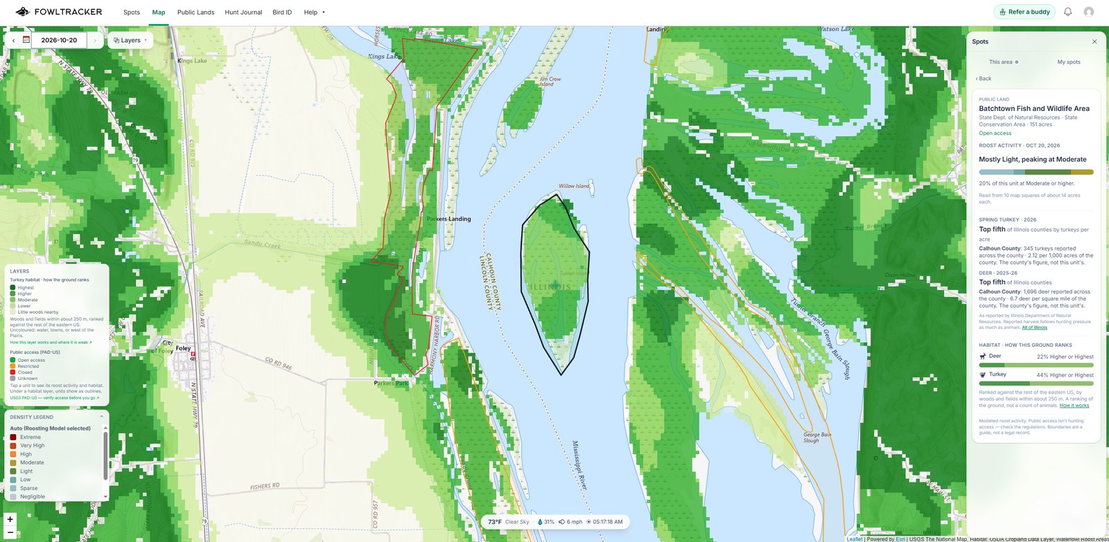
Turkey habitat layer
The woods and field mix, ranked
- Every 100-foot square.
- Scored on the mix of woods and fields in the few hundred yards around it.
- Ranked against the eastern US.
- Highest, Higher, Moderate and Lower are relative to the rest of the eastern US. Solid timber ranks below woods broken up by fields, and bare fields rank lowest.
- A reading wherever you look.
- The Scout tab shows the reading for the center of the map, and every saved spot and hunt journal entry shows how its ground ranks.
Spring turkey on public land
The state's own harvest, unit by unit
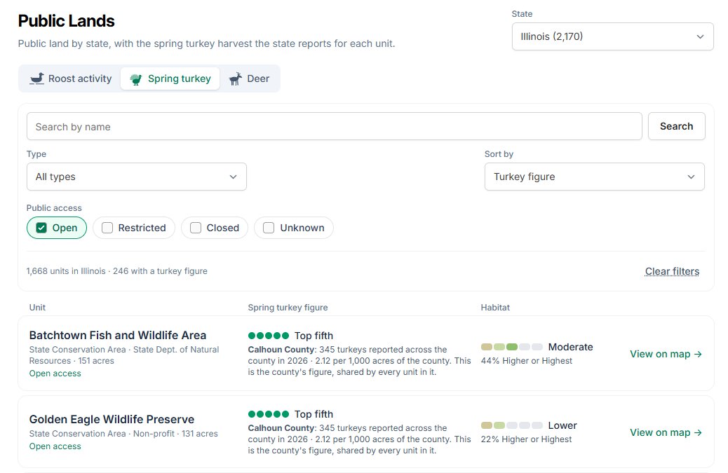
Where a state reports spring turkey harvest, FowlTracker puts it on the public land it belongs to, next to the season dates and bag limit.
- Harvest by area.
- North Carolina game lands and the WMAs, forests and refuges of Florida, Georgia, Kentucky, Oklahoma, South Carolina and Tennessee show the birds the state reported for that area.
- Harvest by county.
- Where the state only counts by county, units show the county figure per 1,000 acres so you can still compare.
- Season and brood survey.
- Each state's spring season dates, bag limit and, where the state runs one, its summer brood survey.
- Sort by habitat.
- Sort every unit in a state by how its ground scores for turkeys. Figures are ranked top fifth to bottom fifth within the state, never against another state.
Spring turkey figures today
- Arkansas
- Florida
- Georgia
- Illinois
- Iowa
- Kentucky
- Maryland
- Missouri
- North Carolina
- Ohio
- Oklahoma
- South Carolina
- Tennessee
- Texas
- Virginia
- West Virginia
Before you drive out
What the turkey data can and cannot tell you
A ranking, not a head count
The habitat layer says how well the ground fits turkeys. It cannot see birds, roost trees, food plots or a creek bottom.
Harvest follows pressure
A high harvest can mean lots of birds, lots of hunters, or both. Read it next to the unit's size and access.
Public is not always huntable
A unit being public does not mean hunting is open there. Check the state's rules for that unit.
Free and Premium
Try it on your own ground first
Free
The turkey layer across the whole eastern US zoomed out, full detail around your first three saved spots, and one sample public land unit per state in full.
Premium
The habitat layer everywhere at every zoom, spring turkey figures for every public land unit, and the habitat sort on the Public Lands list.
Start free and evaluate your own hunting ground.
Start free, save your spots, and see how it lines up with what you are seeing in the field.